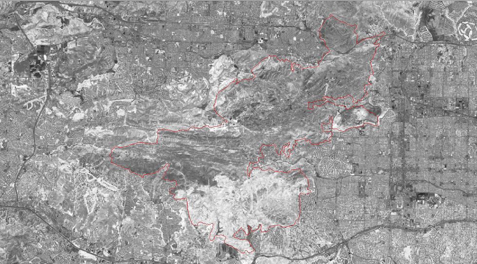
These maps show the study of a forest before, right after, and three years after a fire. These maps were created using ERDAS Imagine and ESRI ArcMap